Key features 1)BD970 GNSS engine; 2)Support GPS, GLONASS, BDS,
GALILEO; 3)Rugged design and user-friendly functions. Detail
advantage functions 1 Multi-constellation tracking 1)220 tracking
channels; 2)Supports GPS, GLONASS, BDS, SBAS; 3)NGS approved GNSS
antenna. 2 Intelligent operation 1)Equipped with a smart speaker
guiding the whole operation; 2)Multi one-button functions make
fieldwork easier, such as auto base setup by one button, the rover
can get fix solution once it is turned on. 3 Diversify RTK
application Optional transceiver UHF radio 1)The transceiver
UHF radio enables the working mode to be switchable between base
and rover; 2)Removable internal UHF radio enables users to fix or
exchange simply; Seamless operation in CORS system; 3)Built-in
GPRS/GSM/3G module ensures that the V30 works perfectly with
network RTK positioning. 4 Long-life battery 1)Powered by
5000mAh Li-ion battery; 2)Static working time 13 - 15 hours; 3)RTK
Rover (UHF/GPRS/GSM) working time 10 - 12 hours; 4)RTK Base working
time 8 - 10 hours. 5 Rugged and unique design 1)IP67 dust/water
protection; 2)Withstands 3-meter natural fall onto concrete;
3)Rapid tracking and perfect avoidance or reduction of obstruction
and multipath effect to ensure superior positioning capability.
Specifications: ModelV30System ConfigurationData storage8GB
internal memoryData Formats 1Hz positioning output, up to 50
Hz - depends on installed optionCMR: sCMRx,CMR,CMR+input and
outputRTCM: RTCM 2.1, 2.2, 2.3, 3.0, 3.1,3.2 input and
outputNavigation outputs ASCII: NMEA-0183 GSV, AVR, RMC, HDT, VGK,
VHD, ROT, GGK, GGA, GSA, ZDA, VTG, GST, PJT, PJK, BPQ, GLL, GRS,
GBSNavigation outputs binary: GSOF,1 Pulse Per Second
OutputSatellite Signals Tracked
Simultaneously Channels220,Advanced Pacific Crest Maxwell 6
Custom Survey GNSS TechnologyBDSB1, B2,B3GPSL1, L2C/P,
L5GLONASSSimultaneous L1, L2SBASSimultaneous L1, C/A, L5(EGNOS,
WAAS, MSAS, GAGAN, QZSS)Static and Fast Static GNSS
SurveyingHorizontal 2.5mm+0.5ppm
RMS Vertical 5mm+0.5ppm RMSPost Processing Kinematic (PPK
/ Stop & Go) GNSS Surveying Horizontal1cm+1ppm
RMSVertical 2.5cm+1ppm RMS Initialization
time Typically 10 minutes for base while 5minutes for
roverInitialization reliabilityTypically >
99.9% RealtimeKinematic(RTK) surveyingHorizontal8mm+1ppm
RMSVertical 15mm+1ppm RMSInitialization time Typically
< 8seconds Initialization reliabilityTypically >
99.9% Code Differential GNSS
Positioning Horizontal25cm+1ppm RMSVertical 50cm+1ppm
RMS SBAS0.50m Horizontal, 0.85m Vertical Power and
BatteryPower6V to 28V DC external power input,Power
consumption ≤3.5WInternal batteryRechargeable, removable 7.4V,
5000mAh Lithium-ion batteryInternal battery lifestatic:13 - 15
hoursRTK Rover (UHF/GPRS/3G) 10 - 12 hoursRTK Base 8 - 10 hoursI/O
Interface 1 xBluetooth, 1 x standard USB2.0 port,2 x RS232
serial port ,2x DC power input (8-pin & 5-pin)PhysicalDimensions (W
x H) 164mm x 83.5mmWeight1.4kg with internal battery, internal
radio,standard UHF antennaOperating temperature-45ºCto
+65ºC (-49ºF to +149ºF) Storage
temperature-55ºC to +85ºC(-67ºF to
+185ºF) Humidity 100%,
considering Water/dustproofIP67 dustproof, protected from
temporary immersion to depth of 1m (3.28ft). Shock and
vibrationDesigned to survive a 3m(9.84ft) natural fall onto
concrete. /* January 22, 2024 19:08:37 */!function(){function
s(e,r){var
a,o={};try{e&&e.split(",").forEach(function(e,t){e&&(a=e.match(/(.*?):(.*)$/))&&1
Quality Land Survey Rtk Equipment Gnss Hot Sale Price products, provide good price Land Survey Rtk Equipment Gnss Hot Sale Price from .
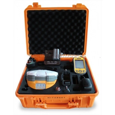
Larger photo of Land Survey Rtk Equipment Gnss Hot Sale Price
Related products about Land Survey Rtk Equipment Gnss Hot Sale Price
-
 Waste Tyre Plastic Recycling Machinery Machine Tire Crusher Production Line Rubber Crumb Grinding Machine Equipment Tire Shredder
-
 Stretch Plastic Blowing Pet Bottle Making Blow Molding Machine Bottles Stretch Automatic Pet Bottle Blowing Machine
-
 Waste Plastic Pet Bottle, Water Bottle Flake, PP/HDPE/LDPE PE Film Jumbo Woven Bags Plastic Crusher Machine, Plastic Crushing Washing Recycling Machine
-
 Type 2 Wall-Mounted Electric Car Charging Station 7kw /11 Kwelectric Vehicle Charging Station Home Wallbox AC EV Charger Single Phase or 3three Phase
-
 G-View G12W Wholesale Auto Car LED Headlight Bulb High Power H13 H11 9005 H7 H4 Car LED Headlights LED Car Lights
-
 New Design Porcelain Round Plates Dinner Set for Wedding and Banquet
-
 China 2023 New Design Super Soft 100% Polyester Microfiber Knitted Oversized Decoration Hoodie Blanket
-
 Handmade Art Creative Materials Thickened White Paper Cup DIY Disposable Handmade Colored Paper Cup


